The Deep History Coast
What is the Deep History Coast?

'Deep history' is increasingly being used in place of the term 'pre-history' and has been coined to reflect the idea that the deeper you delve; the older things are! *
Norfolk's Deep History Coast could embrace the whole of this coastal county but in the context of the initiative promoted by North Norfolk District Council the 'Deep History Coast' refers to the timeless aspect of this coastline which has revealed the most spectacular finds. Happisburgh is one of the oldest archaeological sites in northern Europe, and West Runton yielded the most complete fossilised steppe mammoth skeleton found in the UK.
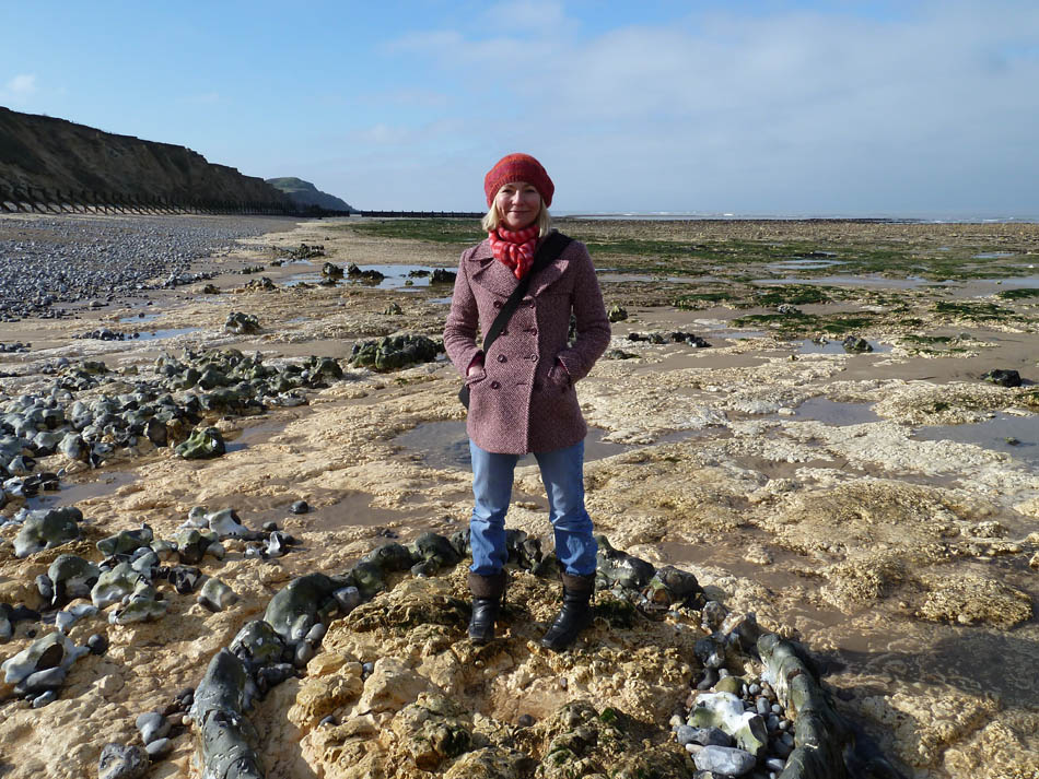
The soft cliffs of this part of Norfolk's coast (between Weybourne and Cart Gap) are considered the best place to study Ice Age geology in the UK - we have one of the fastest receding coastlines in Europe. As soon as they appear new finds can be worn down or buried; leaving archaeologists and geologists to do their work in a race against time.
Finds on the Deep History Coast have provided the earliest evidence for human occupation so far discovered in northern Europe. They place early humans here in Norfolk some 350,000 years earlier than had been thought, at over 800,000 years ago. They also inform and provide a focus for the emerging story of Doggerland - an area of land, now lying beneath the southern North Sea, which connected Great Britain to mainland Europe during the last Ice Age.
The Deep History Coast project hopes to see North Norfolk claim its position as storyteller and voice of authority for the emerging, internationally significant and iconic stories of Doggerland and the early human occupation of northern Europe.
* There are exceptions - especially in North Norfolk, where things can get topsy-turvy due to glacial processes. See this link: Glaciotectonics
How come the Deep History Coast is so special?
The coastline of northeast Norfolk is famous for important discoveries of fossils and archaeology and for the natural beauty of its landscape. Why should this be? By a happy accident - a coincidence of five factors:
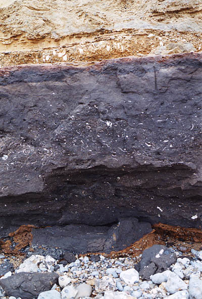
1. A rich sedimentary archive Firstly, the local geology means that there are strata in this area that hold rich evidence of the environments of the geologically recent past. Norfolk's position between the North Sea basin that has been slowly sinking for millions of years and an ancient buried block of hard rocks under southeast England - the London-Brabant Massif - means that it has long been a lowland close to sea level - sometimes covered by shallow seas and sometimes emerging with plenty of marshland, sluggish rivers and estuaries. These are ideal environments for the accumulation of sediments that trap and preserve the remains of animals, plants and archaeology too. In other words, northeast Norfolk has a brilliant and precious sedimentary archive that contains all the clues to what it was like here in Britain in the past two million years or so. Right: The internationally important West Runton Freshwater Bed is exceptionally rich. |
|
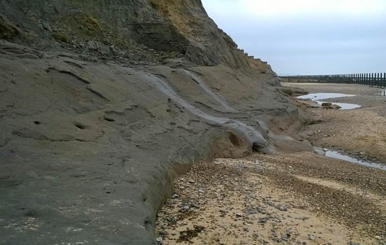 |
2. Protected by a blanket All of the above richness would be for nothing if it had all been eroded away after it was laid down. Fortunately the icesheets of the Anglian Glaciation, around 450,000 years ago, have covered the area with thick deposits of tills, glacial lake clays, and sandy outwash that protected the fossiliferous deposits. But this so called 'glacial drift' is interesting in its own right and the area is internationally important for that reason alone. Left: Cliffs of glacial till at Ostend overlie and protect the Cromer Forest-bed |
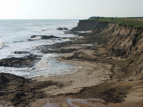
3. Exposed by coastal erosion Just being preserved by burial beneath thick glacial sediments would not be much use to scientists if they are deep underground. They need to be exposed so they can be easily studied. By a combination of the outline of East Anglia jutting out into the North Sea and the soft yielding nature of the cliffs the waves are eating into the land - in some places at an alarming rate. This is a headache for communities who live on the coast but is a bonanza for collectors and scientists. So this area has been the famous for its fossils, especially of big animals, since the early 19th century. Right: Erosion at Happisburgh. |
 |
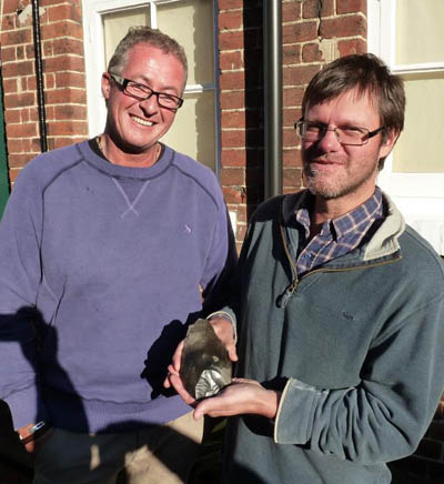 |
4. Discoveries by amateur collectors While there have been scientists visiting the coast for decades they can't be here all the time and they can't be everywhere at once. So, many discoveries have been chance finds made by locals and by keen amateur collectors who visit the beaches regularly. Fossils that wash out are often delicate and easily destroyed by the sea if not carefully removed and preserved in collections or taken to local museums. Without the input of amateur collectors and the general public our knowledge would be so much the poorer. Over the years a number of particularly talented and diligent collectors have contributed the majority of the most spectacular finds to museum collections and reported valuable information for science. Left: Nick Ashton of the British Museum holds a Palaeolithic handaxe brought in to an event at Cromer Museum in 2013. |
|
5. Studied by scientists Just finding interesting stuff on the beach is only the beginning. Without expert study they would simply be old bones and curiosities and of little scientific value. So there needs to be a link between the general public and the scientific community. Some scientists have cultivated friendships with talented local collectors but more often than not local museums - who offer an identification service - are the link with the scientific community. The Happisburgh handaxe was found by Mike Chambers and was taken to Cromer Museum as an enquiry; it set off a major programme of excavation and research and amazing new discoveries. The West Runton mammoth was unearthed by Margaret and Harold Hems who were soon joined by the Norfolk Museums Service to recover a huge pelvis; and that led to major excavations between 1991 and 1995 with material being studied by dozens of experts from many disciplines to extract as much information as possible about the world the beast inhabited. New knowledge is generated by scientists from what looks like very unpromising material. |
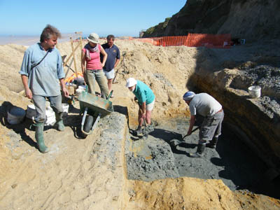 Above: Excavation trench at Happisburgh. |
Keeping records
Context is the key that turns a chance find from just an old fossil to a much deeper understanding of its exact identity, its age, its environment and more. So recording accurate details such as locality (measuring or pacing from a fixed point or by GPS), position in the sediments (a sediment sample can be helpful), a photograph of the specimen in situ and so on can all help. Then contact the local museum or upload photos to the 'Norfolk Fossil Finds' Facebook page to get the ball rolling.
The Deep History Coast app has a feature that adds GPS information to images taken with your mobile phone's camera. To download the app: if you have an iPhone go to the Apple Store and search for DHC explorer app, if you have an android phone go to the Google Play store and search for DHC explorer app.