Field Guide to the Deep History Coast
Wetbourne to Sheringham
Parking: in streets or car parks in Sheringham.
Access: from Sheringham Promenade.
Geology
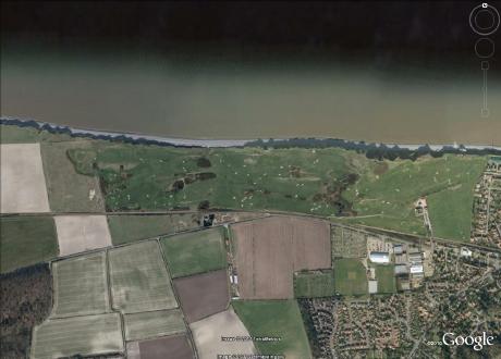
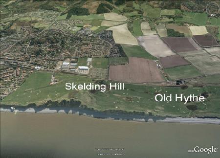
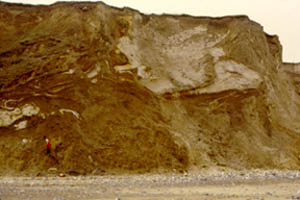
Cliffs to the west of Sheringham display good sections of the Contorted Drift. Below Skelding Hill are Lower Pleistocene deposits (Wroxham Crag) of Pastonian age, resting directly on Chalk. The Wroxham Crag-Chalk unconformity is down approximately to the base of the cliff.
The Contorted Drift is the graphic name given by the Victorian geologist Clement Reid to glaciotectonised glacial sediments in North Norfolk. It is essentially a reworking of earlier glacial materials with addition of Chalk and sand, which often occur in pods and rafts that were being sheared out and incorporated into the till. Paradoxically it is the least deformed glacial materials which appear to be most contorted. Extreme deformation through shearing leads to uniformly mixed diamictons which don't appear deformed at all.
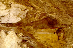
The Chalk on the foreshore forms a resistant shoal (called Robin Friend) which is exposed at low spring tides. In this area and eastwards, flint ammonites are occasionally found (see below). The chemical conditions within the chambers have encouraged the formation of flint. As the inception of this type of diagenesis is related to the organic chemistry of the decaying ammonite, it is sometimes possible to preserve features of the soft parts of the ammonite body.
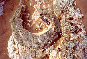
Photograph courtesy of Bill Little, Sheringham