Field Guide to the Geology of North Norfolk
The Cromer Ridge
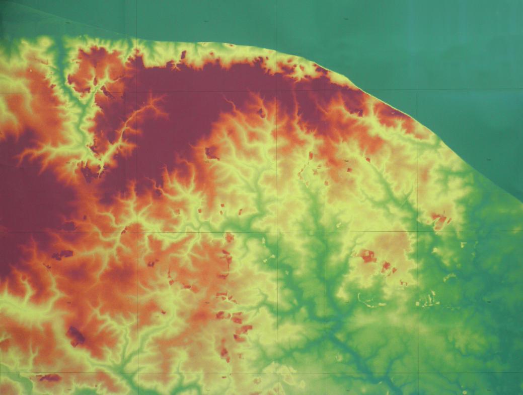 A digital terrain map (DTM) of northeast Norfolk (click the image to enlarge).
The most obvious feature (in red) is the Cromer Ridge that is sub-parallel with the coast at its northern edge and swinging south-westwards towards Holt and finishing at the Briston gap. Though it rises to barely more than 100m above sea level the ridge has a significant impact on the landscape and climate. Its slopes and higher ground are frequently wooded, though formerly it was heathland. It provides a barrier to sea air, so that coastal towns and villages have different microclimates to those on or south of the ridge (fewer frosts, less snow but more fog and mist to the north). Its northern scarp is steeper than the south due its origins as a composite glacial moraine - partly a structural push-moraine and partly a depositional terminal moraine, with outwash plains stretching southwards. Today it is dissected by streams draining into the basins of the River Bure, River Ant and the Mundesley Beck. Notice how the River Glaven draining to the North Sea through Cley makes a sudden dog-leg turn and incises a valley parallel with the axis of the ridge. A possible case of stream capture.
We are very lucky to have the coastal section where it is, because it provides a cross section through the eastern end of the ridge, so its structure and composition can be examined. This gives us the highest cliffs on the coast, rising to almost 60m at Trimingham.
The ridge can be divided into a north-eastern part and an older south-western part. It was originally created as a southwest-northeast structure by ice pressing from the west or northwest. A later advance from the north has truncated the ridge, creating its sharply defined east-west northern edge and generating glaciotectonic structures at Sidestrand-Trimingham (and probably elsewhere). Briton's Lane Pit at Beeston is located approximately at the junction between the two sections of the ridge and the thickness of sand and gravel the outwash from this event.
Structure of the Cromer Ridge
A coherent set of crop marks, seen especially in Google Earth historical imagery of September 2006, shows what is believed to be expressions of sub-surface structures within the drift and indicating pushing by an ice-lobe from the northwest. If you click on the image below, you will zoom in to see the lineations stretching for 10km, from Briton's Lane Pit at Beeston Regis, south-westwards to Hunworth.
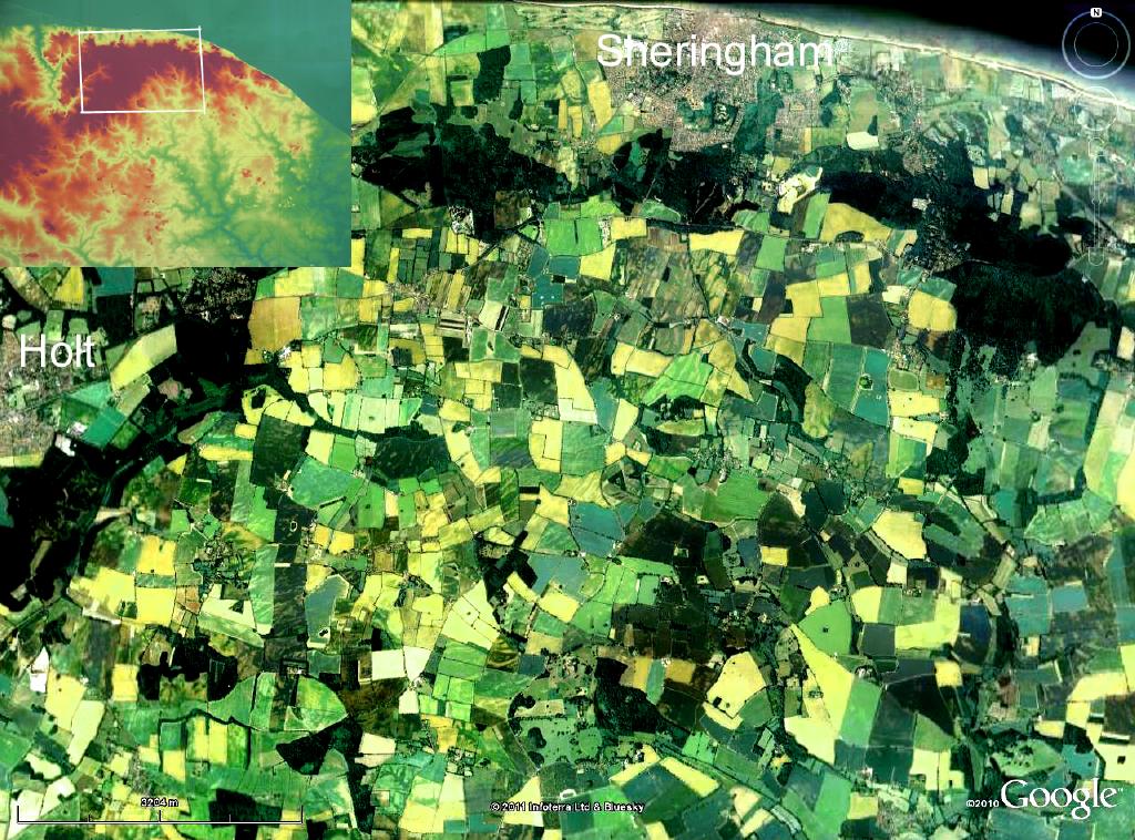
The crop marks in this coherent set appear to be micro-relief - only a metre or two rise and fall - but enough to influence the drainage and hence the growing conditions of crops. As well as lineations that run across fields there are blobs and swirls that may represent the plan view of the different materials of the contorted structure of the drift beneath, with sand basins, till and chalk rafts all folded and compressed by the ice-front as it advanced, retreated and re-advanced time and again to build up the ridge. A programme of auguring will be undertaken in 2011 to investigate the sub-surface composition.
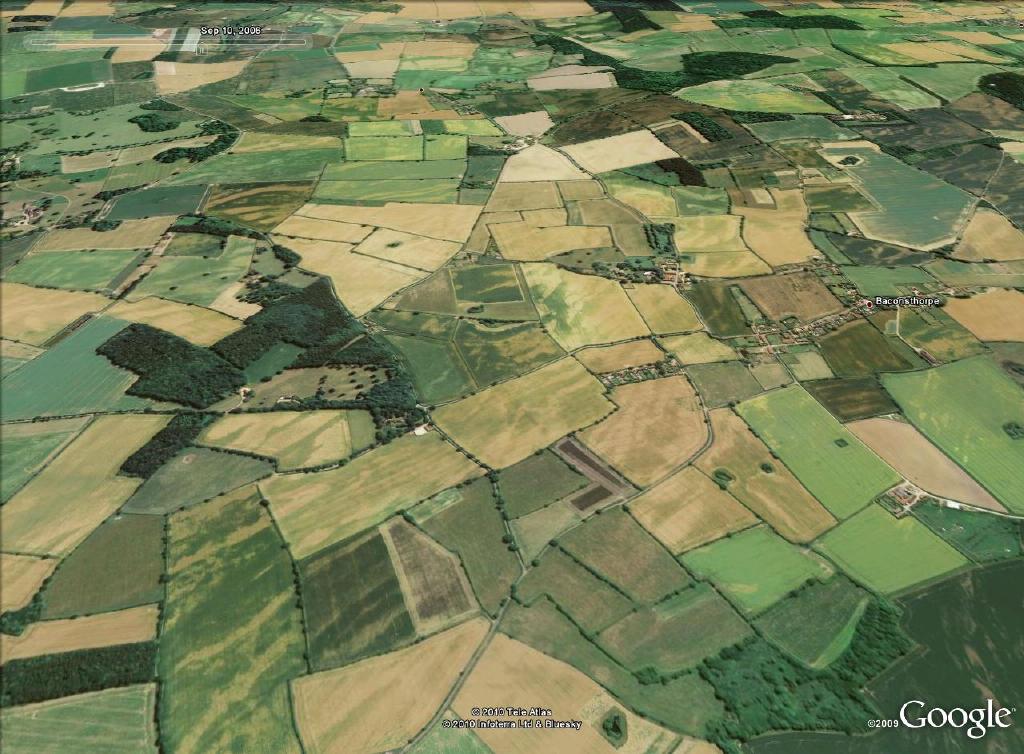
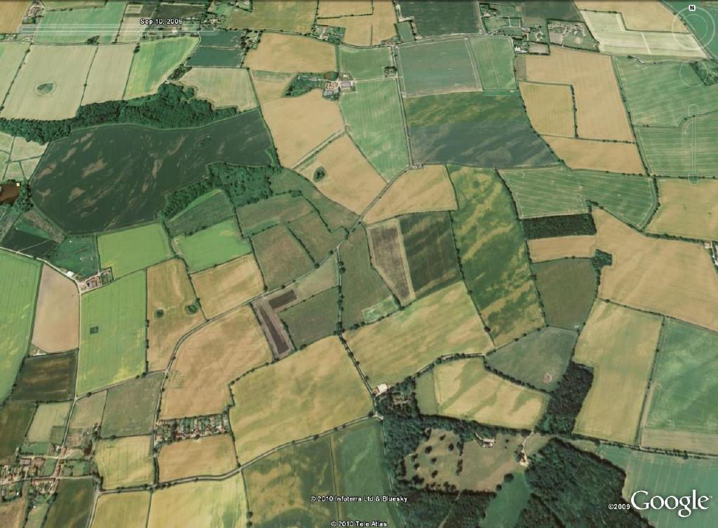
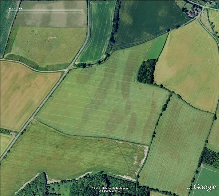
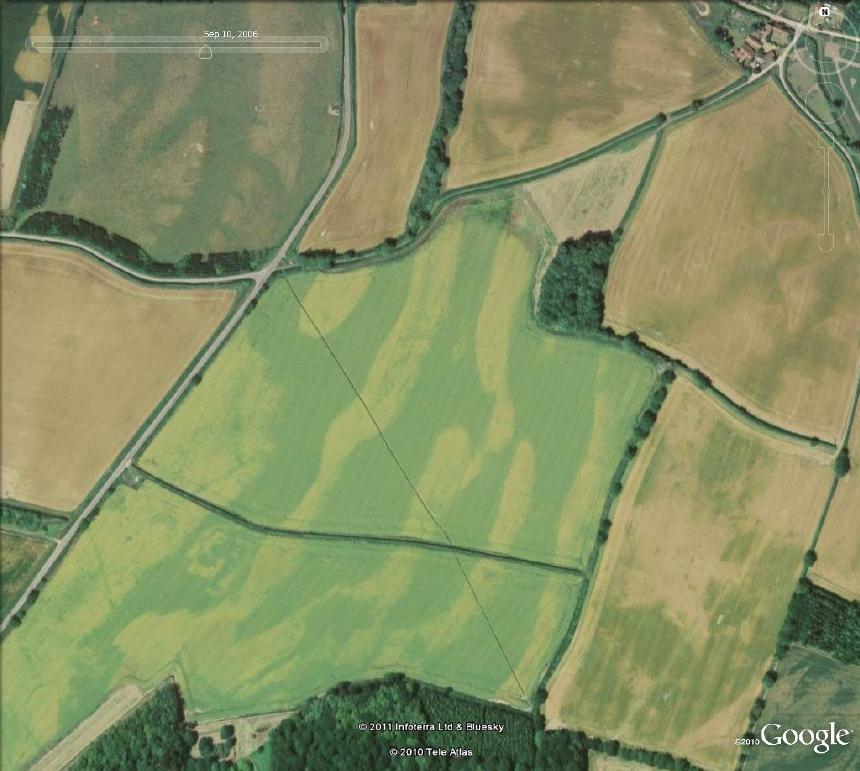
Notice how, although the crop mark pattern is the same in different years (1999 left and 2006 right), the light and dark colouring is reversed. This shows that there truly is a permanent structure at depth that is affecting plant growth, although the effect may vary according to conditions prevailing at the time and the crop that is planted. In unfavourable conditions a crop mark will not appear.
Profile of the ridge
![]() The cross section of the ridge (here exaggerated 3 times) shows a steeper northern scarp. The transect starts from West Runton on the coast. Click on the image to enlarge.
The cross section of the ridge (here exaggerated 3 times) shows a steeper northern scarp. The transect starts from West Runton on the coast. Click on the image to enlarge.
Compiled by Martin Warren. Last updated 15.2.2011