Field Guide to the Deep History Coast
Weybourne
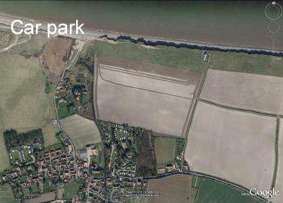
Parking: large car park (pay and display) TG 111146
Access: a road from Weybourne village leads to the beach. The Norfolk Coast Path also passes through here, along the beach from Cley and then on the
cliff top towards Sheringham. At intervals access may be had to the beach from the footpath.
Geology
 Weybourne Gap marks a fundamental change in the coastline. To the east steep cliffs are actively eroded by the sea. To the west the higher ground marking a former coastline stands back from the present-day shore. It is distanced from the sea by salt marshes, shingle ridges and offshore bars. The change in the character of the coast has been linked with the nature of the Chalk, which is harder to the east. It is also related to the glacial-interglacial history, especially the Anglian glaciation, the formation of the Cromer Ridge and the former coastline during high sea levels stands. At a more fundamental level the marked east-west orientation of the north Norfolk coast is very likely controlled by a postulated deep-seated fault in basement Palaeozoic rocks (BGS map memoir).
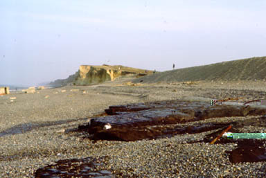
Image: Weybourne Hope, where the shingle spit of Blakeney Point meets the cliff. The old saying 'He who would all England win, should at Weybourne Hope begin' refers to the deep inshore water that would allow ships to unload troops and stores here in the event of an invasion. The image shows eroding Holocene marsh deposits in the foreground in the 19080s; Chalk cliffs beyond.
The shingle spit of Blakeney Point meets the coast here. It has grown westwards by littoral drift and has migrated inland over the old salt marshes at almost 1 metre per annum in recent centuries, keeping pace with the erosion of the cliffs. A reedy mere beside the car park is created by the partial blockage of Weybourne Beck by the beach. On the seaward side of the shingle beach valley deposits up to 2 m thick are sometimes exposed, which contain stone age to modern artefacts. Further east for several hundred metres are former marsh deposits (Weybourne Marsh) outcropping in the middle and low foreshore. Low hillocks immediately behind the beach are made of Chalky till (Marly Drift) of the Anglian glaciation.
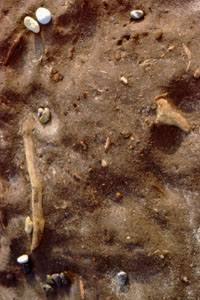
Images: Detail of the Holocene sediments on the foreshore at Weybourne. Lower marly sediments (left) and the upper peaty sediments containing wood above (right).
Wroxham Crag
Resting on the top of the Chalk is a marine deposit of interbedded gravels, sands, silts and clays, the coarser strata often being very iron-stained. It was known formerly as the Weybourne Crag but now known as the Wroxham Crag. The change of name is for two reasons. Firstly, the British Geological Survey (BGS) prefers not to have more than one unit with the same name. Thus there was the Weybourne Town Till, Weybourne Chalk and the Weybourne Crag. Secondly, at it's type locality the deposit was at the feather edge of its outcrop and neither as complete a sequence nor as typical of the unit as it was elsewhere. So, when sections and boreholes were described at Wroxham they became the type deposit.
The Weybourne Chalk
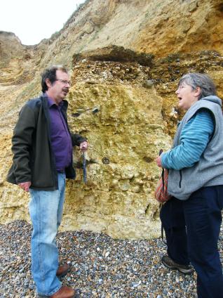
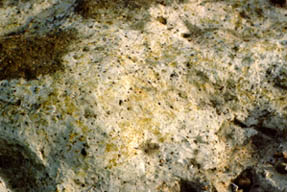
Weybourne Chalk (Campanian, zone of Belemnitella mucronata) occurs in the lower cliffs and foreshore, dipping gently east (towards Cromer). For about 50m east of the public car park at Weybourne beach the Chalk of the cliff is glaciotectonised, that is, curiously nodular and flints and fossils such as belemnites are fractured, usually with some displacement. Sub-horizontal shear planes caused by glacial ice moving across the area from west to east have cut through flints and fossils (see images).
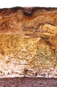 Marine sands and gravels of the Weybourne Crag rest on Chalk. In the vicinity of the gap at the western end of the section the Crag is partially removed and disturbed by glaciation. The upper parts of the cliff is composed of till and outwash (Contorted Drift) of the Anglian glaciation. The top of the Chalk, a former land surface dips eastward until at the west end of Sheringham Promenade it is almost at beach level.
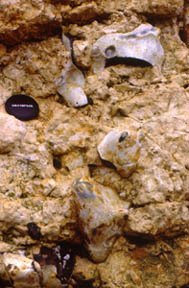
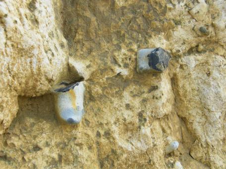
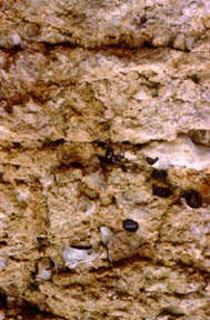 The Chalk outcrops in the foreshore but often obscured by beach material. Clusters or 'nests' of Echinocorys scutata sea urchins occur here. A few metres of brown-stained Chalk are visible in the cliff, overlaid by Pleistocene sediments. The feather edge of Wroxham Crag just reaches westwards as far as Weybourne, resting on Chalk but the top of the cliff is largely composed of glacigenic sediments. The Chalk here is nodular, possibly due to 'solution compaction' and sheared by glacial forces from the west, as evidenced by flints broken in situ and low angle thrust plains.