Field Guide to the Deep History Coast
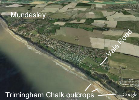
Trimingham to Mundesley
Parking:
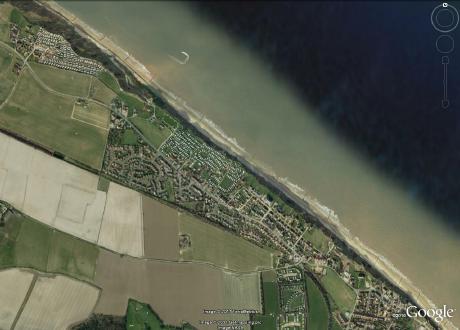
Little Marl Point (TG 297380) and Mundesley (TG 309371)
Access:
From the Coast Road (A149) turn into Vale Road, north of Mundesley (TG 298377, which quickly becomes an unmade road leading to the cliff edge and then, with a
left turn, becomes tarmac road again that descends the cliff to the beach, where there is a small car park perched on Little Marl Point.
Several access points in Mundesley itself.
 |
 |
Length:
Vale Road (Little Marl Point) to the ramp at SE end of the sea front: 2.5 km
Geology
The main feature at Mundesley is the high cliff, that provides an oblique cross-section through the southern (distal) side of the Cromer Ridge. In this we can see the structure, which is dominated by low angle pro-glacial thrusts. These have dislodged pre-existing materials such as the conspicuous Chalk and the super-incumbent Cromer Forest-bed and even earlier tills, and have piled them up to form the higher ground of the ridge. The southern margin of the ridge is here quite pronounced, forming the steeper slopes to the north of Mundesley Beck, especially at Cock's Hill and Mundesley Golf Course (TG 299366).
Trimingham Chalk

Above: The youngest Chalk in the UK, a glacial raft of Trimingham Chalk with a low angle glacial thrust above it.
The glacial disturbance gives us a unique chance to study the youngest Chalk in the British Isles, the Lower Maastrichtian Trimingham Chalk in the coastal section at Little Marl Point. This would otherwise be below sea-level, but by virtue of glaciotectonic uplift a number of tilted and folded rafts are available, as wave-cut platform remnants on the foreshore and a section remaining in the lower cliff (see phooto above). Unfortunately the foreshore chalk platforms are not often exposed now and the cliff section is degraded. Below the small car park at the bottom of the access road from Vale Road one could collect the small oyster Ostrea lunata and other fauna.
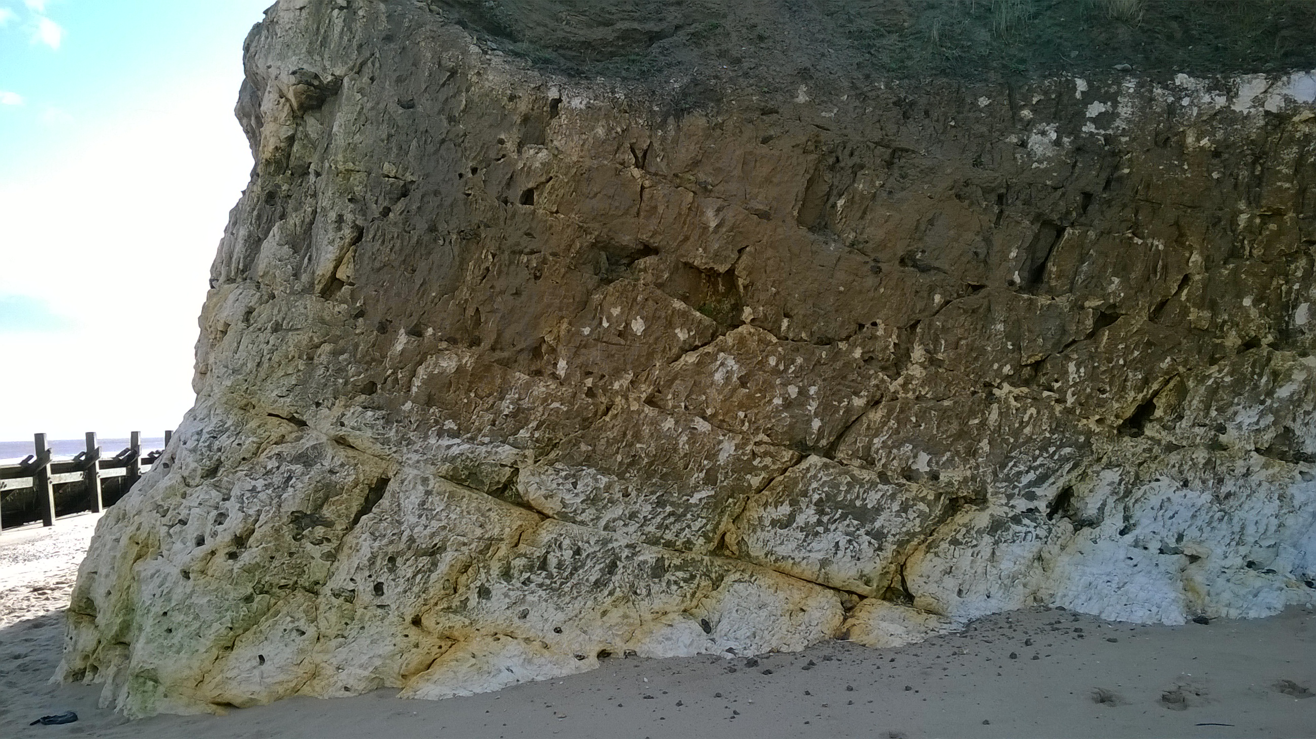
Above: A glacial raft of Lower Maastrichtian Chalk tilted 20° southwest.
Ipswichian channel
A small river channel with organic deposits occurs at a high level in the cliff at Mundesley. It was reported in Victorian times but is not exposed nowadays. Linda Phillips (Phillips, 1976) examined the fossil remains in collections and sank a borehole through it in a small parcel of land adjacent to the car park of the Ship public house (Latitude 52°52'38.86"N, Longitude 1°26'21.47"E). She concluded that this was of Ipswichian age, with a fauna that included European pond tortoise (Emys orbicularis). It must have been related to the valley of the River Mun in the Ipswichian interglacial (MIS 5e), some 130,000 years ago.
Fossils
Old collections contain large vertebrate specimens from the Lower Middle Pleistocene of Mundesley but since the coast protection works were built the exposure of the Cromer Forest-bed has been very limited. A notable amateur collector was Dr John Miller (not to be confused with his son Dr John Miller, also a GP in Mundesley), who was in practice there in the 20th century. The best of his collection was acquired by the Norwich Castle Museum in 2000. A very fine horse jaw with lower incisors and the toothrow of molars was among that collection.
References
Peake, N.B. and Hancock, J.M., 1961. The Upper Cretaceous of Norfolk. in The Geology of Norfolk, editors G.P. Larwood and B.M. Funnell, pp. 326-330.
Phillips, L., 1976. Pleistocene vegetational history and geology in Norfolk. Philosophical Transactions of the Royal Society of London. Series B, Biological Sciences
Stuart, Anthony John, 1979. Pleistocene occurrences of the European Pond Tortoise. Boreas Volume 8, Issue 3, pages 359-371, September 1979