Field Guide to the Deep History Coast
Sheringham to Beeston Regis
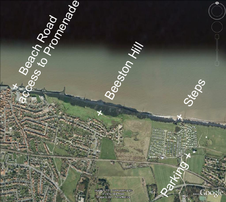
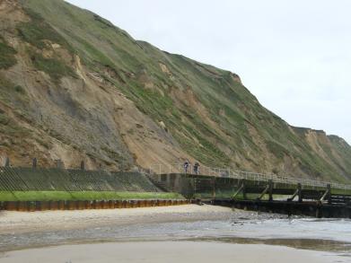
Parking: in streets and car parks in Sheringham, or at Beeston Regis Church.
Access: from Sheringham Promenade but a better way is to park at Beeston Regis church (extreme right of picture) and make your way to a set of private steps down the cliff north of Beeston Regis Caravan Park. There is a public footpath that skirts the southern and western perimeter.
Geology
The shallow eastward dip of the Chalk provides good outcrops of a series of hard grounds in the Beeston Chalk (Late Campanian) along the foreshore section east of Sheringham at low water. The Chalk is fossiliferous and interesting faunas have been collected from here.
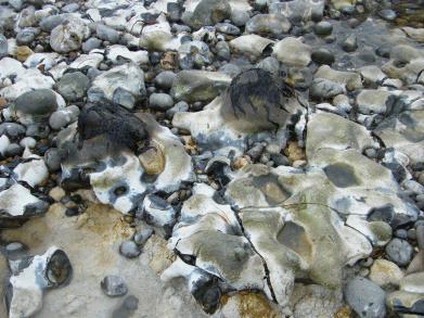
There is sometimes exposure immediately below Beeston Hill and to the east. The upper surface of the Chalk is brecciated, implying an old land surface subjected to peri-glaciation and solifluction. Up to 7 m of Pleistocene sediments (Wroxham Crag) are present below the till in the cliff to the east of the stream at Old Kiln but it is often poorly exposed. The sequence is complex, with marine and freshwater deposits of the Pre-Pastonian (cold) stage, Pastonian (temperate) and Beeston (cold) stages (West, 1980). Involutions and ice-wedges indicate the severity of the conditions from time to time. Elephant remains have come from here, probably the remains of a single skeleton that has gradually been exhumed by cliff erosion. See the fine jaw of Mammuthus trogontherii in the Zoology Museum, Cambridge from 150m east of concrete steps below Beeston Hill.
 Beeston Hill is composed of glaciotectonised Happisburgh Till (glacial sediments of the Anglian stage). These are the same sediments and processes that built the Cromer Ridge and the 'bump' should be regarded as a mini-ridge (Hart, 1987).
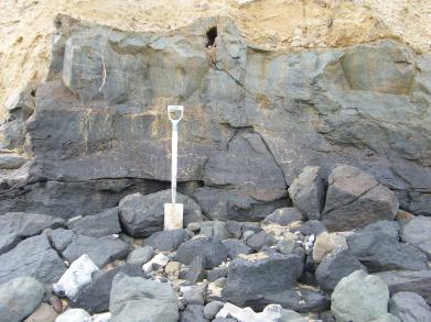
 The Happisburgh Till shows tremendous deformation, resulting from the forces exerted by overriding ice coming from the west (Lee, J. and Phillips, E. British Geological Survey. Geologists' Association Field Trip, West Runton, Norfolk. Saturday 18 September 2010). This is evident from chalk blocks that became entrained in the till and were sheared out, with boudinage structures, pale wisps and stratification.
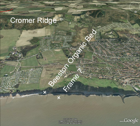
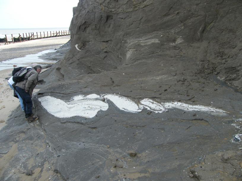
 At the base of the cliff to the east of the Sheringham Promenade are freshwater organic beds that outcrop extensively in the Beeston Regis section but yield only sparse fossils. West (1980) called these bed i, referring them to a temperate stage (Pastonian), older than the Cromerian West Runton Freshwater Bed. Simon Parfitt at the Natural History Museum (personal communication) believes that may be older still, possibly 1 Ma, on the basis that the Carpinus pollen reported by West may in fact be Hophornbeam (Ostrya sp.) and the palaeomagnetism is normal rather than reversed. If this is true, then this is a time period that is not well known, so he encourages further research and sieving of this deposit.
References
Hart, Jane K., 1987. The Genesis of the North East Norfolk Drift. PhD. Thesis UEA
Phillips, E.R., Lee, J.R. & Burke, H.F. 2008. Progressive proglacial to subglacial deformation and syntectonic sedimentation at the margins of the Mid-Pleistocene British ice sheet: evidence from north Norfolk, UK. Quaternary Science Reviews. 27, 1848-1871
West, R.G., 1980. The pre-glacial Pleistocene of the Norfolk and Suffolk coasts. Cambridge University Press. 34-45