Field Guide to the Deep History Coast
The West Runton Freshwater Bed
The West Runton Freshwater Bed (WRFB) is a remarkable deposit of international importance. It is one of the few deposits on the Norfolk coast that can be relied upon to be exposed, at least to some extent and to yield fossil material on a regular basis. As such it has been the favourite haunt of collectors, amateur and professional. The bed was first described in the 19th century and over the years has yielded an extensive faunal and botanical list that in some cases is the earliest know occurrance of a taxon. It tells us a great deal about the environment and climate in the interglacial period that has been named the Cromerian and this is its stratotype locality. The 'Cromer Complex' of the Dutch sequence includes several warm periods but determining which of them equates to this, the Type Cromer sensu stricto is problematic. Various methods of estimating the date place it somewhere in the range 500,000 to 780,000 years. Thus, it may equate to Marine Isotope Stage 15 (<621 ka) or 17 (<721 ka).
Prior to the formal work of Professor Richard West (published 1980) it was known as the Upper Freshwater Bed, differentiating it from the Lower Freshwater Bed of greater antiquity, which occur in small outcrops and represent a variety of ages. With the recognition that the numerous exposures of organic muds along the coast were of different ages the term Upper Freshwater Bed has been dropped in favour of the West Runton Freshwater Bed being applied to the Runton locality alone and other deposits are refered to as contemporary with West Runton, pre-West Runton or post-West Runton where this can be determined.
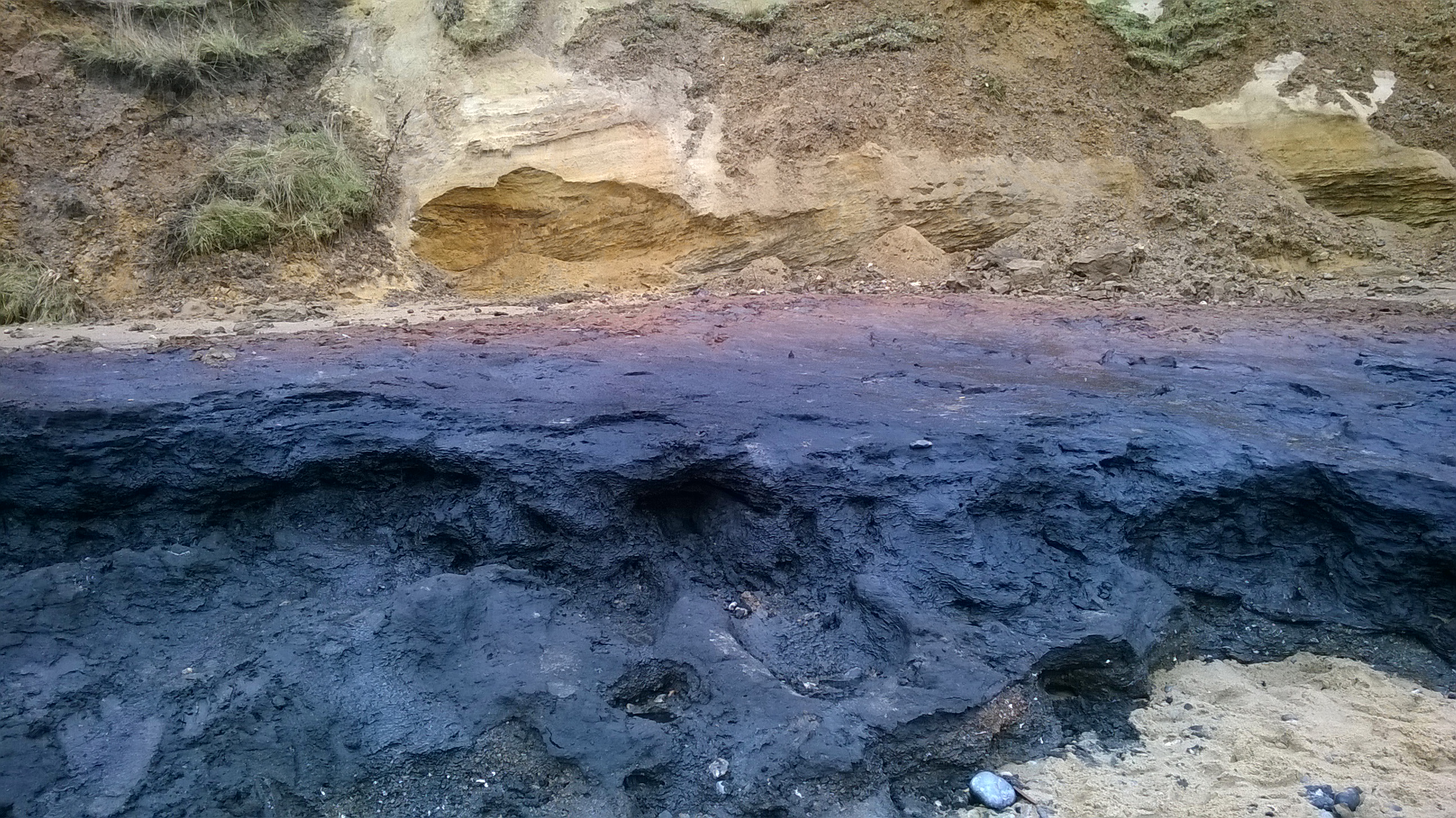
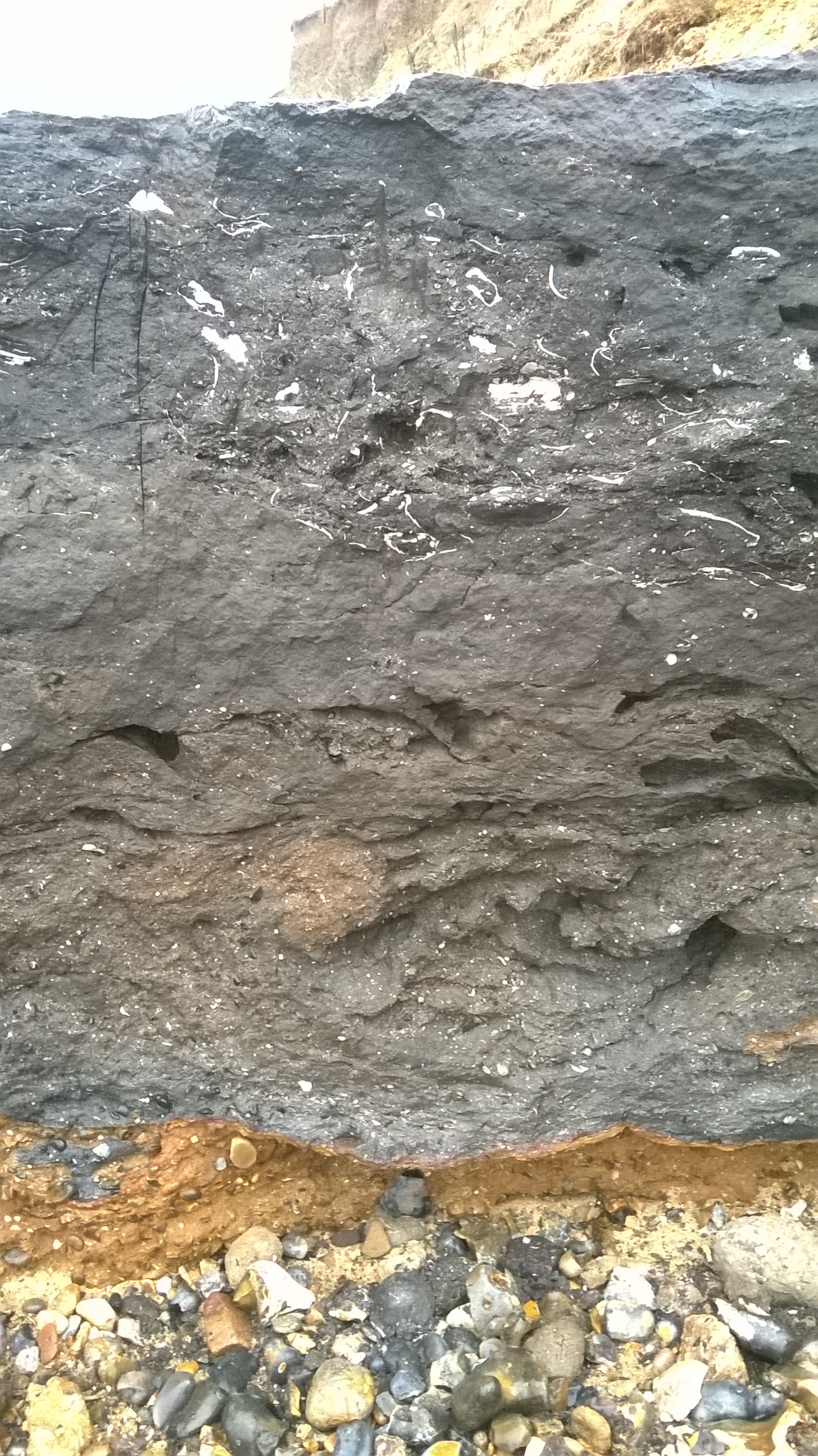
The principal deposit of the WRFB is a lens-shaped organic sandy mud about 260m wide from just west of Woman Hythe (West Runton Gap) to just beyond Goss' Gap to the east. It is about 1.6 m thick at the deepest part and thinning gradually westwards but ending more abruptly to the east of Goss' Gap. In recent decades the width of the central channel has been shortening at its eastern end as the cliff has been eroded. Thus the eastern end at the time of writing (2017) is only a few metres east of Goss' Gap and Goss' Gap itself is barely a feature at all, marked only by an iron drainage pipe and a dribble of water coming out of the cliff. Two smaller swales occur, one to the east of Goss' Gap and one to the west of Woman Hythe and these occasionally yield fossils but not to the same extent as the large central deposit. Beneath the WRFB are orange sands and gravels assigned to the preceeding Beestonian cold stage. The top of the WRFB is defined by a marine transgression with a lag gravel resting directly on top (The Monkey Gravel, on account of the discovery of the finger bones of a Macac Macaca sp.)which is succeeded by tidal sands and silts and then by freshwater sands that are assigned to the Anglian cold stage. A sharp contact at the top of the freshwater sands defines the base of the glacigenic deposits of the Anglian stage, including tills, and outwash sands and gravels. The glacial deposits are heavily sheared and glaciotectonised in a formation known to the Victorian and later geologists as the Contorted Drift.
Click on images to enlarge. Use back button to return.
 |  |
 |  |
 |  |
Lithostratigraphy
Based on pollen analysis R.G.West described how the WRFB covers a period of climatic amelioration from the cool conditions of the late Beestonian stage represented by a marl at the base, to fully temperate conditions of Cromerian substage IIb at the top. The Monkey Gravel and the tidal sediments above the WRFB are assigned to Cromerian sunstage III. Thus, only the first half or so of the Cromerian interglacial cycle are represented at the stratotype locality.
Datum Points and the importance of recording
This internationally important deposit is exceptionally rich in fossils and is visited by many collectors, amateur and professional scientific. All are encouraged to report their finds for science and posterity to the Norfolk Museums Service, who are keeping a database of fossil finds from the Cromer Forest-bed (which includes this West Runton Freshwater Bed). Send images and findspot details, or take specimens for identification and recording to:
Dr David Waterhouse,
Norwich Castle Study Centre,
Market Avenue,
Norwich
NR1 3JQ
Phone: 01603 493625
Email: david.waterhouse@norfolk.gov.uk
Your specimens will be returned to you (but you will have to collect them) after recording, unless of course if you are donating material to the public collection. If more convenient, you may also leave specimens at Cromer Museum and they will be forwarded to the Norwich Castle Study Centre for identification and recording. You can collect your specimens a few weeks later.
As the WRFB contains beds from different substages it will be especially useful scientifically if full stratigraphic and locality data are reported with the finds. To help you here are some pointers to useful datum points and a guide to the strata identification.
The primary datum, as used by Professor Richard West in his 1980 monograph The Pre-Glacial Pleistocene of the Norfolk and Suffolk Coasts is the beginning of the sea wall at Woman Hythe (West Runton Gap). In the photograph below the datum is at the bottom of the picture while in the distance the WRFB can clearly be seen beyond the sea wall.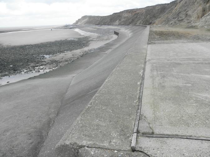
It is useful to have secondary datum points for ease of recording when actually on the WRFB, so here are some temporary datum points:
[No image] Datum 2. The eastern end of the sea wall is 82.4m east of the Woman Hythe datum. | 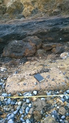 Datum 3. The nearest (western) end of a small concrete block adjacent to the WRFB is 145.7m east of Woman Hythe datum. Only temporary (2017), as it could move. |
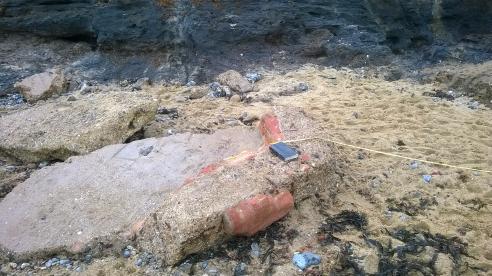 Datum 4. The nearest (western) edge of the largest concrete block infront of the WR Mammoth site (with part of the hexagonal form of the original pill box) is 235.9m east of the Woman Hythe datum. | 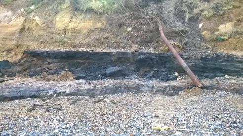 Datum 5. The water pipe at Goss' Gap (to the straight section, not the bent bit) is 313.4m east of Woman Hythe datum. The far eastern end of the WRFB central swale is also in the image (left). |
Compiled by Martin Warren. Last edited 9.2.2017